


6023 Langtalereckhütte
Description
Scenic mountain and e-bike route surrounded by countless glaciers in the Ötztal Nature Park.
Map & elevation profile
The Tour
Scenic mountain and e-bike route surrounded by countless glaciers in the Ötztal Nature Park.
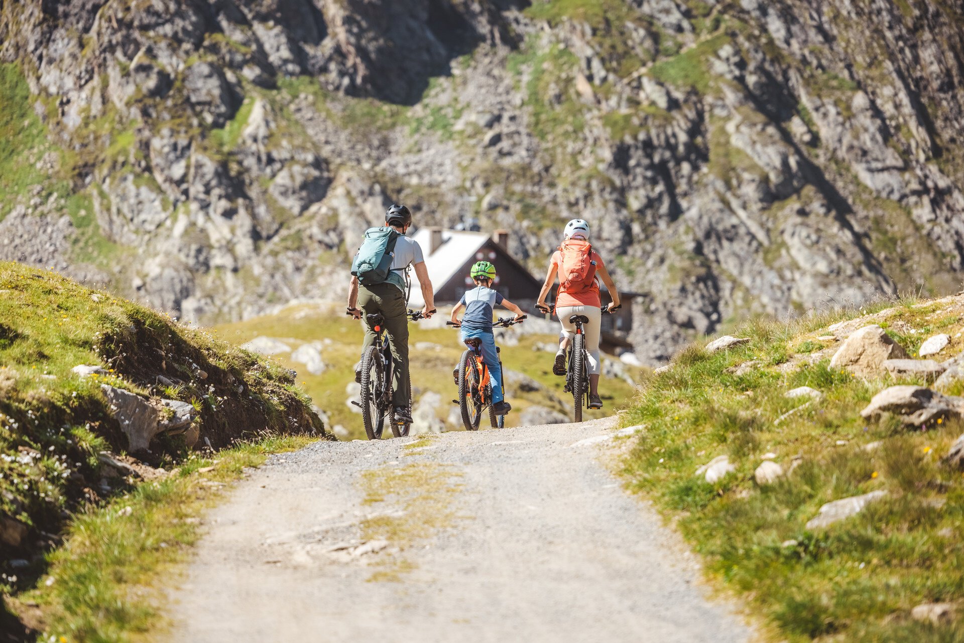
One of the top routes in the region leads deep into the Ötztal glacier world, up to the Langtalereckhütte. The starting point Obergurgl, located at the end of the Gurgler valley, is already at 1,910 meters above sea level. Technically, the approx. 7-kilometer-long gravel road is not overly demanding. However, the consistently high gradient percentages take their toll.
Along the Gurgler ski area, the ramp first climbs to the Schönwieshütte (2,270 m, refreshment stop). You circle the Schönwieskopf and lose 50 meters of elevation on a short descent. A good chance to catch your breath before the final climb.
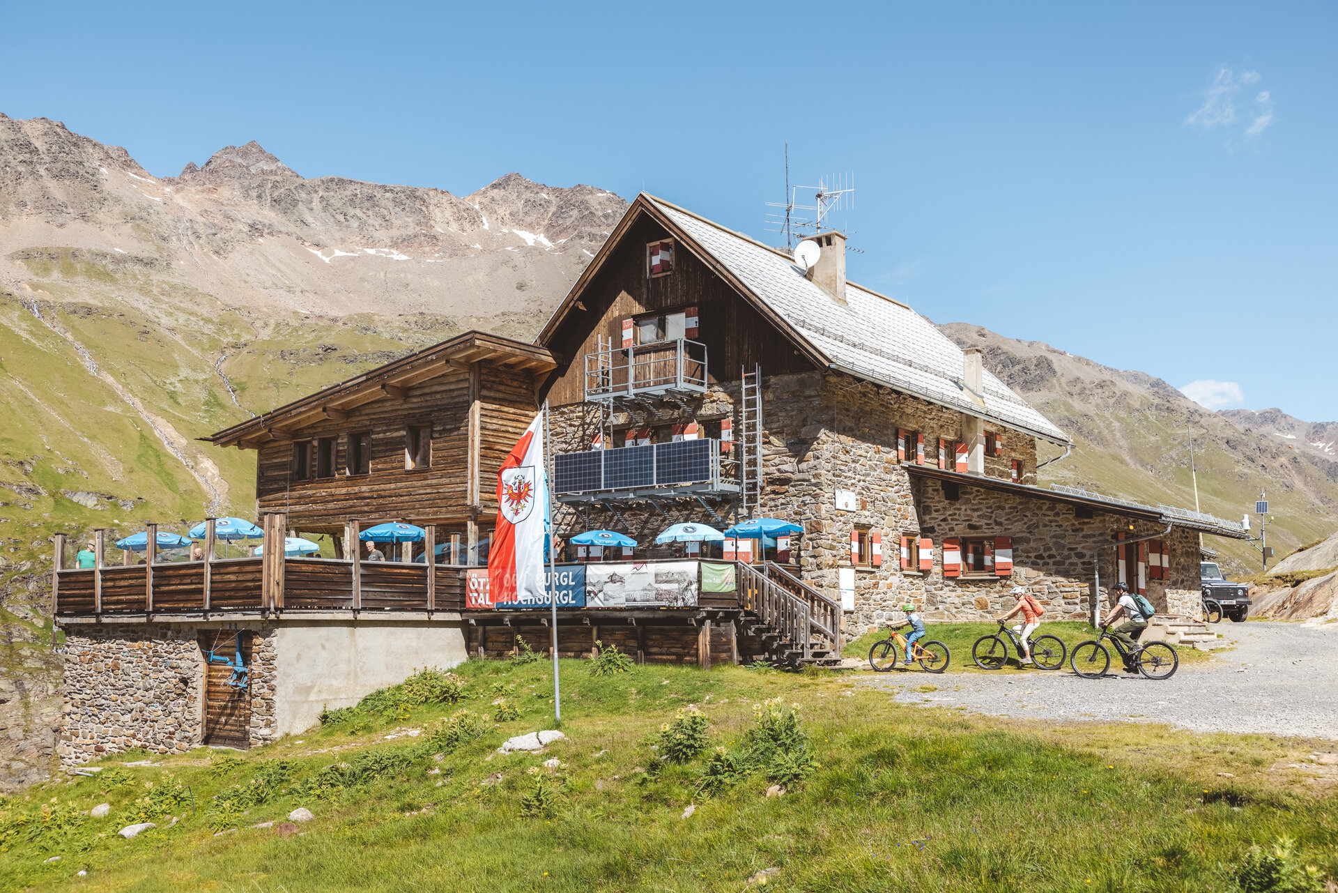
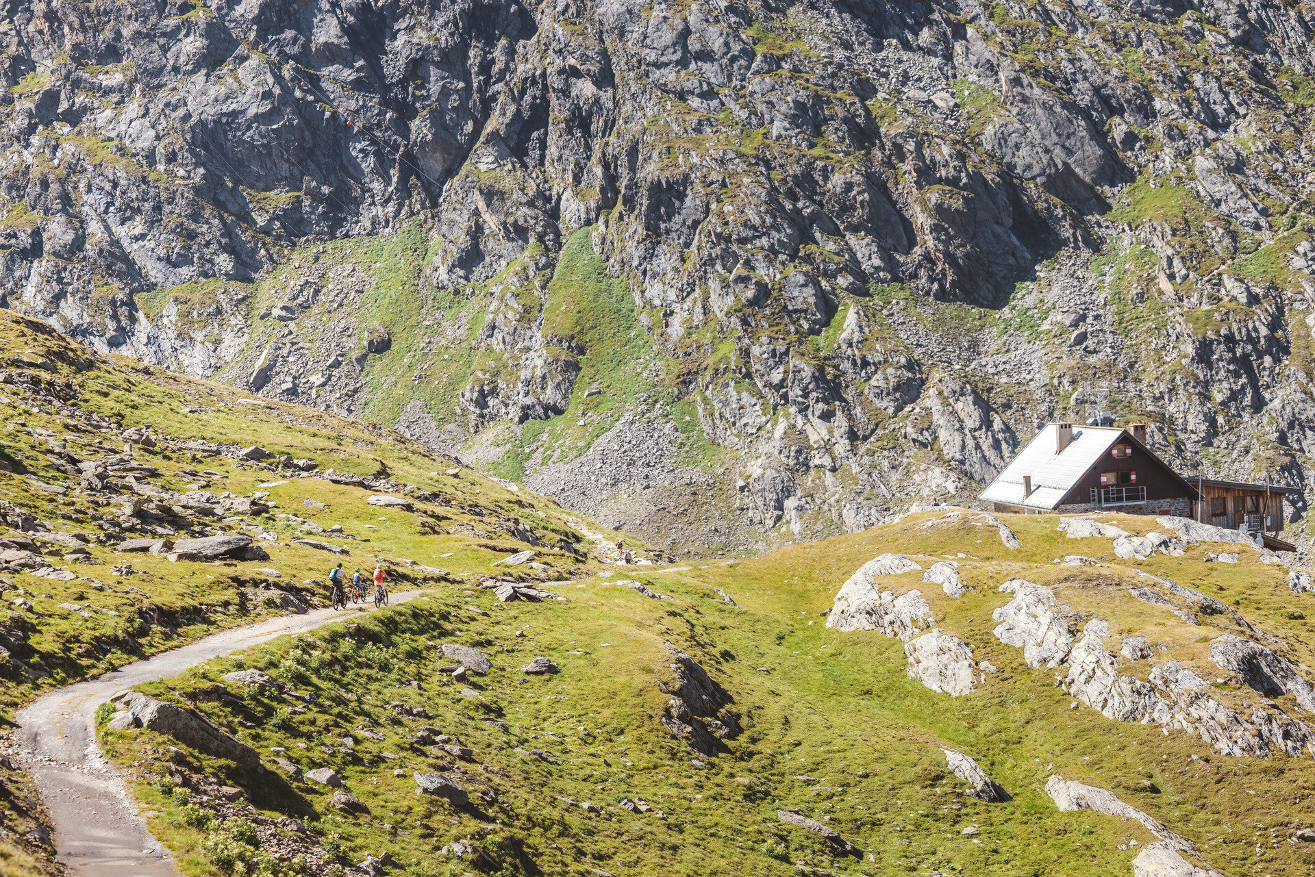
The path then climbs in several stages to the destination at Langtalereckhütte, and thus to the well-deserved snack. The hut lies at the edge of a peculiar valley basin, whose planed rock shows that here once ended the tongue of the Gurgler Ferner. Today, however, the eternal ice has retreated towards the main ridge. Nevertheless, the view of the sparkling snowfields at Kleinleitenspitze and Schalfkogel impresses. The descent leads back to Obergurgl along the approach route.
This route runs along developed roads and can easily be ridden with a motorized e-mountain bike or a classic mountain bike without motor.
Regions & Places
Mountain areas
Details
Characteristics
Way types
Safety guidelines
Sporty cycling skills and defensive riding behavior are required for the partly steep ascents and more challenging downhill sections, and the demands on fitness and riding technique are rated as medium. 'The focus is on sporty, active (enjoyment) cycling'
Additional information
More information about biking & cycling in the Ötztal: https://www.oetztal.com/biken
Directions
The starting point of this route is at the church in the center of Obergurgl. There, you will find the Piccard Monument, which commemorates the emergency landing of the Swiss scientist Auguste Piccard in May 1931 on the Gurgler Ferner. You ride past the church to the junction 'Guggelar', where the paved road turns into a wide gravel path. If you follow the paved road, you shortly reach the beginning of the stone pine forest, a 300-year-old natural monument. Through the stone pine forest, besides a popular geocaching loop, runs a nature-themed trail that introduces visitors to the nature, wildlife, and history of the region over 15 stations. Further on, you ride below the stone pine forest on a gravel road towards Schönwieshütte and Langtalereckhütte up to the middle station of the Hohe Mut gondola lift. Leaving the bikes at the lift, a small detour by gondola to Hohe Mut Alm is recommended. Upon arrival, you will be surprised by a magnificent panoramic view of countless three-thousand-meter peaks and more than a dozen glaciers. Truly the most beautiful lookout mountain in Tyrol. In the lower floor of Hohe Mut Alm, there is an exhibition by the Ötztal Nature Park on the topic 'Glaciers – Climate – High Alpine Research', which includes, among other things, a 300-year-old ibex horn and glacier ice that you can touch. The gondola takes you back to the middle station. From here, you continue with the bike. You follow the gravel road ascending over the Schönwieskopf towards Schönwieshütte. Here at the foot of the breathtaking Rotmoostal, many Haflinger horses can be found during summer months. The path climbs in several stages to the destination, the Langtalereckhütte, and the well-deserved snack. The hut lies at the edge of a peculiar valley basin. Once the tongue of the Gurgler Ferner ended here. Today, however, it has retreated towards the main ridge. In summer 2017, the new Piccard Bridge was built on the Gurgler Ferner to secure the crossing between Langtalereckhütte and the Ramolhaus for hikers. The bridge is definitely worth a trip from Langtalereckhütte and can be reached on foot in just over an hour. The return to Obergurgl is along the wide ascent path, passing by Schönwieshütte and the Hohe Mut lift.
Arrival
Public transit
Travel comfortably and safely by train to the Ötztal station. The final stop or exit point is ÖTZTAL station. Afterwards, you can conveniently and quickly travel through the entire valley to your desired destination by public transportation or local taxi companies! The current bus schedule is available at: http://fahrplan.vvt.at
Starting point
Getting there
The car journey to the ÖTZTAL. Located in Tyrol, the Ötztal branches off to the south as the longest side valley of the Eastern Alps. Travel by car takes visitors through the Inn valley to the entrance of the valley and then continues along the Ötztal. Besides the toll highway, country roads can also be used. Your trip can be quickly and conveniently planned with the route planner.
To the route planner: https://www.google.at/maps.
Parking
The following parking options are available in Gurgl:
Parking garage village center Obergurgl (down to the right in front of the church), paid | € 2.00 per hour
Parking garage entrance of the village – valley station Festkoglbahn, paid | € 6.00 per day
Parking lot Hochgurglbahn valley station, free of charge – no overnight parking
Parking lot Top Mountain Crosspoint, free of charge
Parking lot Hochgurgl, free of charge (very small parking lot)
Current information
Midsummer-like hot
The tour is within these protected areas.
Equipment
Suitable equipment such as breathable clothing and weather-appropriate outdoor wear, bike helmet, gloves, sunglasses, and a GPS device or map material. For bike tours without refreshment stops, sufficient provisions are necessary.