")


Löple Trail (678)
Description
A connection between two alpine huts, an up and down – and a lot of fun: The red Löple Trail runs for just over a kilometer
on the edge of the republic.
Map & elevation profile
The Tour
A connection between two alpine huts, an up and down – and a lot of fun: The red Löple Trail runs for just over a kilometer
on the edge of the republic.
The Löple Trail can be ridden well in both directions – from the Gaislach Alm to the Löple Alm and vice versa. It runs for just over a kilometer on the edge of the BIKE REPUBLIC SÖLDEN through forest and along a meadow path (the surface here is damp-resistant). The route is fairly flat but includes a short, steep descent. Technically it is challenging, but not too demanding.
You can reach Löple via the significantly more challenging Nene Trail, which you can reconnect to after an uphill. Or you can come from the high alpine Fernar Trail as part of the Long Trail Fernar: Fernar, Nene and Schteckler Trail form the most demanding route in the entire BIKE REPUBLIC – extremely challenging both physically and technically!
Please watch out for hikers!
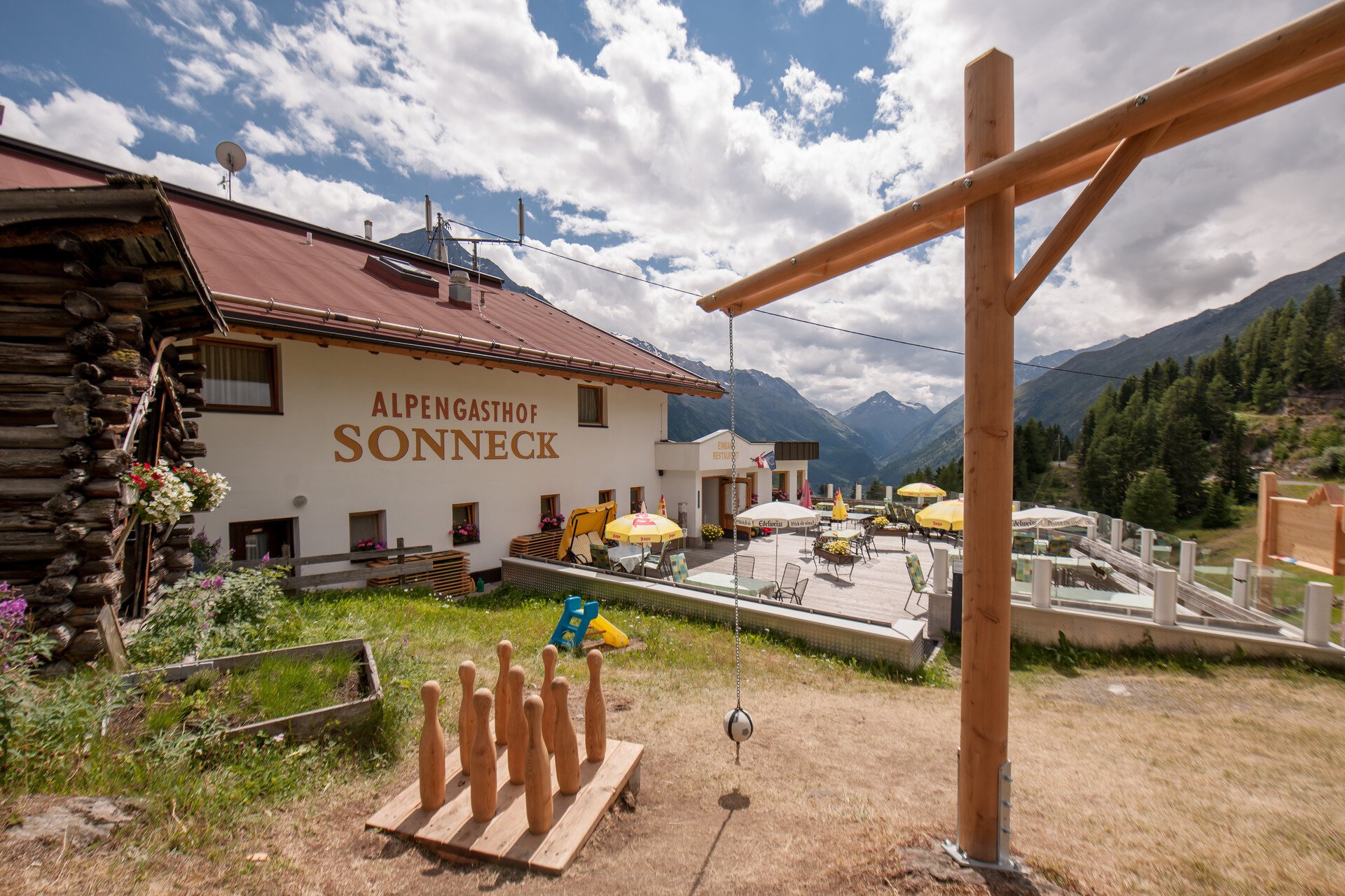
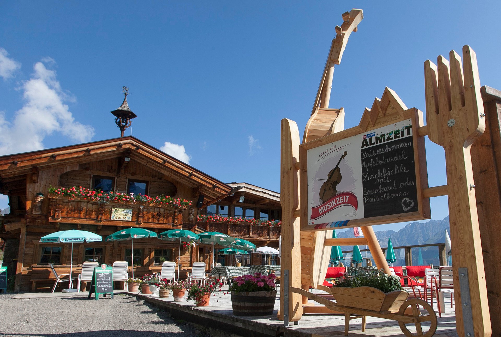
The trail conveniently leads from one culinary stop to the next: from the Gaislach Alm to the Löple Alm or vice versa.
Regions & Places
Mountain areas
Details
Characteristics
Way types
Safety guidelines
The Löple Trail is a red route. You should have some technical riding skills, but it does not pose a very big challenge.
At BIKE REPUBLIC SÖLDEN, it's all about shared fun with bike sports – no matter what riding level you have. Be considerate of each other and support each other. And behave with the same respect towards all other people on the mountain and in the valley – and towards nature.
–> Stay on the paved and signposted paths. Do not ride across open meadows!
–> Avoid locking the rear wheel and thus help preserve the trails.
–> Be considerate of animals & close the pasture gates. There can be cows on the trails and lines at any time. Ride carefully and keep your distance!
–> Please note: Hikers also use the nature trails of BIKE REPUBLIC SÖLDEN. Ride carefully, stop when necessary, give way considerately, and greet nicely.
Single trail difficulty
Additional information
More info about biking & cycling in the Ötztal: https://www.oetztal.com/biken
More info about probably the most flowy nation of the Alps, BIKE REPUBLIC SÖLDEN: https://bikerepublic.soelden.com
And more videos here: https://www.youtube.com/c/BikeRepublicSöldenSoeldenSolden
Arrival
Public transit
Arrival by train
Get to Ötztal train station at the valley entrance easily by train. From the station forecourt, a shuttle bus departs towards Obergurgl. The bus ride to Sölden takes about 1 - 1.5 hours. On the designated bike shuttle buses, bike transport (including eMTBs) is free with a valid bus ticket.
All important information about bus schedules, connections, and taxi companies can be found here.
Starting point
Getting there
WHERE IS SÖLDEN?
Sölden is located in the west of Austria in the state of TIROL, in a southern side valley of the Inn Valley – the ÖTZTAL.
Arrival from the west:
From Vorarlberg to Tirol via the Arlberg Pass or through the Arlberg Tunnel (S 16) - Landeck - Autobahn A 12 towards Innsbruck - Exit Ötztal towards Roppener Tunnel - B 186 (35 km) to Sölden
From the north:
- Bad Tölz - Achen Pass - B 181 - Jenbach - A 12 Innsbruck towards Bregenz - Exit Ötztal - B 186 (35 km) to Sölden
- Pfronten - Reutte - Fern Pass - Imst - A 12 towards Innsbruck - Exit Ötztal towards Roppener Tunnel or B 171 Tiroler Straße to Ötztal (vignette-free) - B 186 (35 km) to Sölden
- Garmisch Partenkirchen - Ehrwald - Lermoos - Fern Pass - Imst - A 12 towards Innsbruck - Exit Ötztal towards Roppener Tunnel or B 171 Tiroler Straße to Ötztal (vignette-free) - B 186 (35 km) to Sölden
- Garmisch Partenkirchen - Mittenwald - Scharnitz - Seefeld in Tirol - Telfs - A 12 towards Bregenz - Exit Ötztal or B 171 Tiroler Straße to Ötztal (vignette-free) - B186 (35 km) to Sölden
From the east:
From Munich or Salzburg on A 93 to Kufstein, then on A 12 towards Bregenz over Innsbruck to exit Ötztal, then continue on B 186 (35 km) to Sölden
From the south:
Coming from Bolzano towards Brenner (toll road) - Brenner Autobahn via toll station Schönberg towards Innsbruck - from Innsbruck on A 12 towards Bregenz to exit Ötztal - continue on B 186 (35 km) to Sölden
Parking
PARKING:
There are enough parking spaces at the base stations of the Gaislachkoglbahn and Giggijochbahn, and parking garages are also available.
Parking spaces are subject to a fee.
Overnight parking for cars is possible for a fee in the Gaislachkogl parking garage:
more information about overnight parking
Please respect that wild camping is prohibited!