
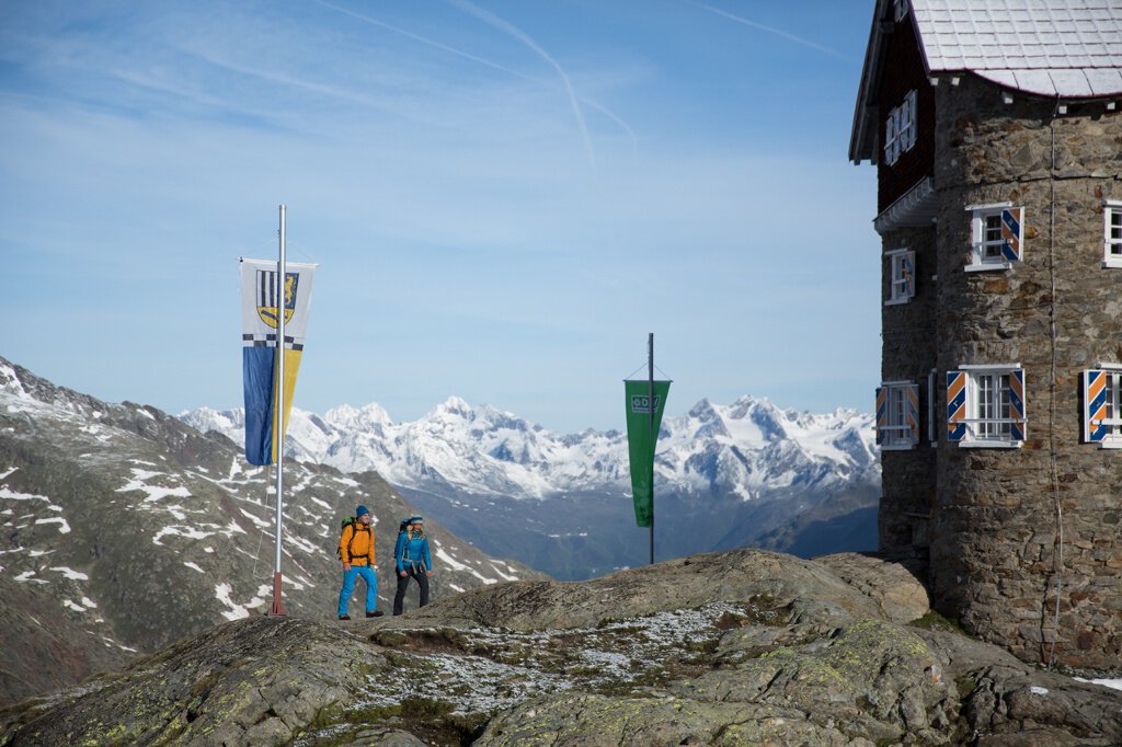
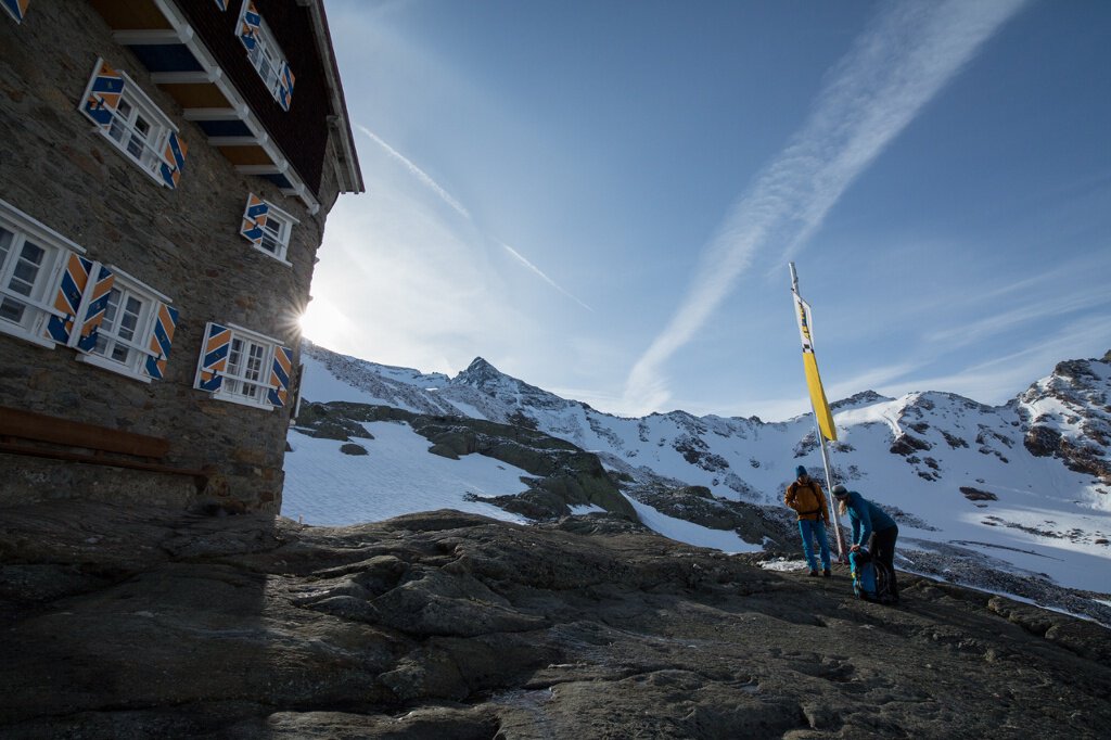

Siegerland Hut
Map & elevation profile
The Tour
WINDACHALM/ FIEGL'S GUESTHOUSE --> Gaisstabl --> SIEGERLAND HUT
The Siegerland hut stands on a height of 2,710m - directly at the foot of the highest mountains in the Stubai Alps.
The hike starts at Windachalm/ Fiegl's hut and continues through the wide Windach valley to the Siegerland hut.
Enjoy the view of the gentle pasture areas, deep gorges, a waterfall and glacial polish.
In summer there is a hut taxi that runs from Sölden to Windachalm/ Fiegl's guesthouse. This saves you the way from Sölden to Windachalm.
Regions & Places
Mountain areas
Details
Characteristics
Way types
Safety guidelines
Red mountain trails are moderately difficult: some narrow and steep but secured walking and climbing passages await hikers. The corresponding signs are in a yellow base color and feature a red circle as the difficulty level indicator.
Moderately difficult mountain path; suitable for sure-footed and experienced mountain hikers; good physical condition, mountain experience and mountain equipment (see under equipment) are necessary.
Please check the current weather report at: https://www.oetztal.com/de/sommer.html
Additional information
More info about hiking in the Ötztal: https://www.oetztal.com/wandern
Recommended literature
Recommended maps
Directions
The hike starts at Windachalm/ Fiegl's hut. From there, the wide path through the Windach valley is unmistakable. You walk about 3 km on this path until the junction to the Hildesheimer hut.
From there, the path becomes a narrow trail. You cross a stream and then continue towards the Siegerland hut.
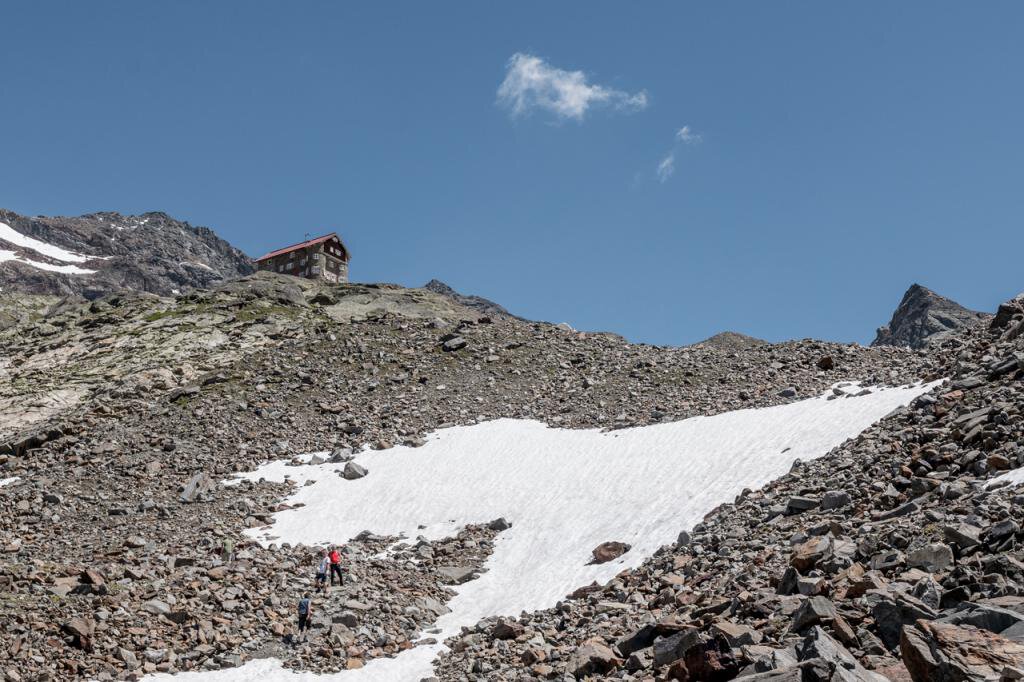
After a short time, a marked route leads steeply up through the wide cirque to 2,710m to the Siegerland hut.
The descent follows the same path as the ascent and takes about 2.5 hours.
Arrival
Public transit
Travel comfortably and safely by train to the Ötztal train station. The final stop or exit point is ÖTZTAL station. Afterwards you can conveniently and quickly travel through the entire valley to your desired destination with public transportation or local taxi companies.
The current bus schedule is available at: http://fahrplan.vvt.at
Starting point
Getting there
Car travel to the ÖTZTAL.
Located in Tyrol, the Ötztal branches off to the south as the longest side valley of the Eastern Alps. Travel by car leads travelers over the Inn valley to the valley entrance and then along the Ötztal. In addition to the toll motorway, country roads can also be used.
You can quickly and conveniently determine your route with the route planner: Route planner: https://www.google.at/maps
Parking
The following parking options are available in Sölden:
- Postplatz parking lot
- Giggijochbahn + underground car park
- Gaislachkoglbahn + underground car park
The parking lots in Sölden are subject to a fee.
For parking over several days (e.g. hut route):
- Gaislachkoglbahn parking garage - parking ticket either online or directly at the Gaislachkoglbahn ticket office
Current information
The tour is within these protected areas.
Equipment
Appropriate equipment such as breathable and weather-appropriate outdoor clothing, ankle-high hiking boots, wind, rain and sun protection, a hat and possibly gloves are recommended! It is also important to bring sufficient provisions as well as a first aid kit, a mobile phone and possibly a hiking map.