")

Stallwies Trail (6042)
Description
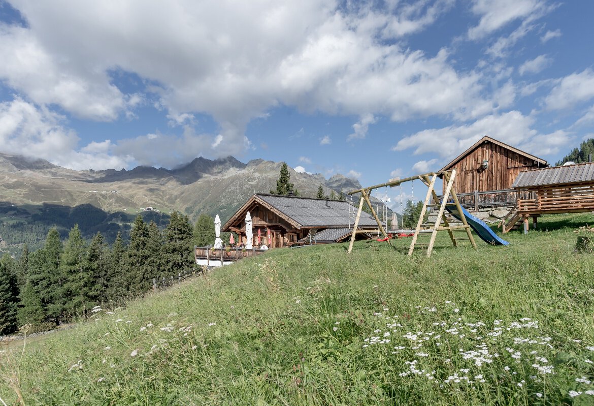
The red Stallwies Trail is a short but fine trail on the quiet (lift-free) side of the BIKE REPUBLIC SÖLDEN.
Map & elevation profile
The Tour
The red Stallwies Trail is a short but fine trail on the quiet (lift-free) side of the BIKE REPUBLIC SÖLDEN.
To the Stallwies Trail – like all natural trails on the quiet side of Sölden – you first have to pedal about 500 vertical meters uphill. From the last hairpin before Kleble Alm, turn off towards Lochle Alm. The trail entrance then lies to the right. For just under a kilometer, it goes through the forest below the forest road. Although the Stallwies Trail is by no means as demanding as the really hard Jägers Notweg (which starts nearby), technical skill is still recommended: There are rocky passages and many roots. It ends on the forest road shortly before the junction to Stallwies or Kleble Alm.
The Stallwies Trail can be combined with the Lochle Alm Trail.
Please watch out for hikers!
If you continue pedaling towards Stallwies or Kleble Alm, you can stop there perfectly.
Regions & Places
Mountain areas
Details
Characteristics
Way types
Safety guidelines
The Stallwies Trail is a red route with some rocky sections and many roots.
In the BIKE REPUBLIC SÖLDEN it’s all about sharing fun in bike sport – no matter your riding level. Be considerate of each other and support one another. Behave just as respectfully towards all other people on the mountain and in the valley – and towards nature.
–> Stay on the paved and signposted paths. Do not ride over open meadows!
–> Avoid blocking the rear wheel and help preserve the trails.
–> Be considerate of animals & close the pasture gates. Cows may repeatedly stand on trails and lines. Ride cautiously and keep your distance!
–> Please note: Hikers also use the natural trails of the BIKE REPUBLIC SÖLDEN. Ride carefully, stop, yield considerately and greet nicely.
Single trail difficulty
Additional information
More info about biking & cycling in the Ötztal: https://www.oetztal.com/biken
More info about the probably flowiest nation of the Alps, the BIKE REPUBLIC SÖLDEN: https://bikerepublic.soelden.com
And more videos are here: https://www.youtube.com/c/BikeRepublicSöldenSoeldenSolden
Arrival
Public transit
Arrival by train
Easily by train to Ötztal station at the valley entrance. A regular bus starts directly from the station square towards Obergurgl. The bus ride to Sölden takes about 1 - 1.5 hours. In the designated bike line buses, bike transport (including EMTBs) is free with a valid bus ticket.
All important information on bus schedules, connections, and taxi companies can be found here.
Starting point
Getting there
WHERE IS SÖLDEN?
Sölden is located in the west of Austria in the federal state of TIROL, in a southern side valley of the Inn valley – the ÖTZTAL.
Arrival from the west:
from Vorarlberg to Tirol via the Arlberg pass or through the Arlberg tunnel (S 16) - Landeck - Autobahn A 12 towards Innsbruck - exit Ötztal to Roppener tunnel - B 186 (35km) to Sölden
from the north:
- Bad Tölz - Achen pass - B 181 - Jenbach - A 12 Innsbruck towards Bregenz - exit Ötztal - B 186 (35km) to Sölden
- Pfronten - Reutte - Fern pass - Imst - A 12 towards Innsbruck - exit Ötztal to Roppener tunnel or B 171 Tiroler Straße to Ötztal (toll-free) - B 186 (35km) to Sölden
- Garmisch Partenkirchen - Ehrwald - Lermoss - Fern pass - Imst - A 12 towards Innsbruck - exit Ötztal to Roppener tunnel or B 171 Tiroler Straße to Ötztal (toll-free) - B 186 (35km) to Sölden
- Garmisch Partenkirchen - Mittenwald - Scharnitz - Seefeld in Tirol - Telfs - A 12 towards Bregenz - exit Ötztal or B 171 Tiroler Straße to Ötztal (toll-free) - B186 (35km) to Sölden
from the east:
from Munich or Salzburg on the A 93 to Kufstein, then on the A 12 towards Bregenz, over Innsbruck to exit Ötztal, then on B 186 (35km) to Sölden
from the south:
coming from Bolzano towards Brenner (toll road) - Brenner Autobahn via toll station Schönberg towards Innsbruck - from Innsbruck on A 12 towards Bregenz up to the approach to Ötztal - then on B 186 (35km) to Sölden
Parking
At the valley stations of the Gaislachkogl cable car and the Giggijoch cable car, sufficient parking spaces are available including parking garages. Parking spaces are subject to a fee.
Paid overnight parking of cars is possible in the Gaislachkogl parking garage:
more information about overnight parking
Please respect that wild camping is forbidden!
Current information
The tour is within these protected areas.
Equipment
Well-equipped rules! We recommend wearing MTB protective gear (helmet, knee, elbow, back protectors, etc.) on all lines, trails, enduro tracks, and mountain bike routes of the BIKE REPUBLIC SÖLDEN. All trails are exclusively for use with mountain bikes that meet today's quality standards.